APT Again!
Published by Arun Isaac on
Tags: radio, satellite, rtlsdr, sdr, weather

Figure 1: NOAA 15 on 26-07-2013 at 1753 IST in Nagercoil
My two and a half month vacation at the end of my undergraduate studies is over. And, I am now in IISc, Bangalore for my MTech course in Computational Science. But, towards the very end of my vacation, I managed to reconstruct a double cross antenna and use my newly procured Realtek TV tuner card SDR to receive a few more images from the NOAA weather satellites.
The image above was captured from NOAA15 on a very low pass (a max elevation of around 21 degrees) over the Arabian Sea on 26-07-2013. It is the monsoon, and my home town of Nagercoil was experiencing very cloudy weather and intermittent showers. My brother was soaked in rain, holding up the antenna to receive this one. Still, I suppose it was worth it! The Indian coast is not visible, but the cloud formation over the Arabian Sea is seen in good detail. At the very top of the image, the Persian Gulf coast is also visible.
Below are two smaller images – the first from NOAA15 and the second from NOAA19 – both on 27-07-2013. The edges had a lot of white noise. So, I had to crop them off.
The first image is another slightly higher pass over the Arabian Sea (a max elevation of around 40 degrees, if memory serves me right). Not much, other than more cloud cover is visible.
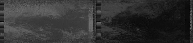
Figure 2: NOAA 15 on 27-07-2013 at 1728 IST in Nagercoil
The second image is an almost overhead pass (a max elevation of around 86 degrees). Sri Lanka, and the southern tip of the Indian peninsula are seen in superlative detail.
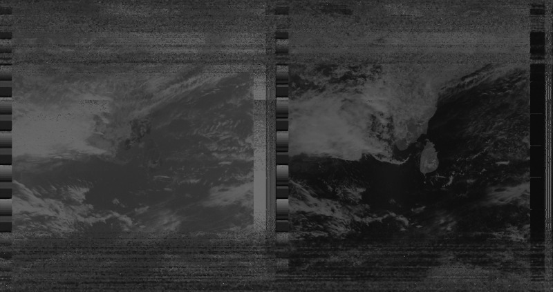
Figure 3: NOAA 19 on 27-07-2013 at 1343 IST in Nagercoil
It is quite possible for someone to ask why, in the age of the Internet and the Television, and realtime weather reports, we need APT images. To be fair, APT is pretty low resolution, and we do not “need” them, per se. But, and a big BUT, you will never know the joy of building your own equipment, and receiving your very own satellite images, until you have actually done it!
 All content is licensed under a